Galetovec (1.265 m)
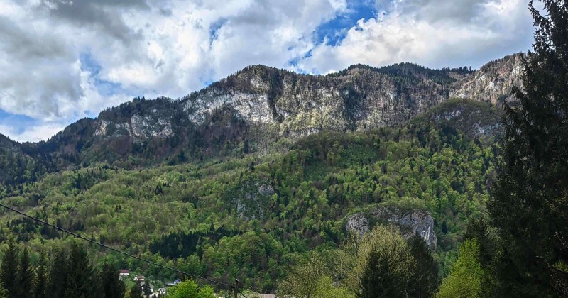
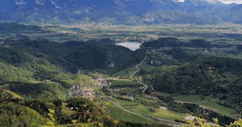
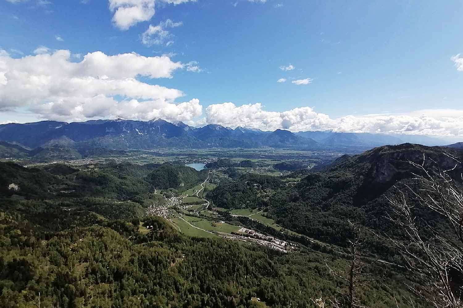
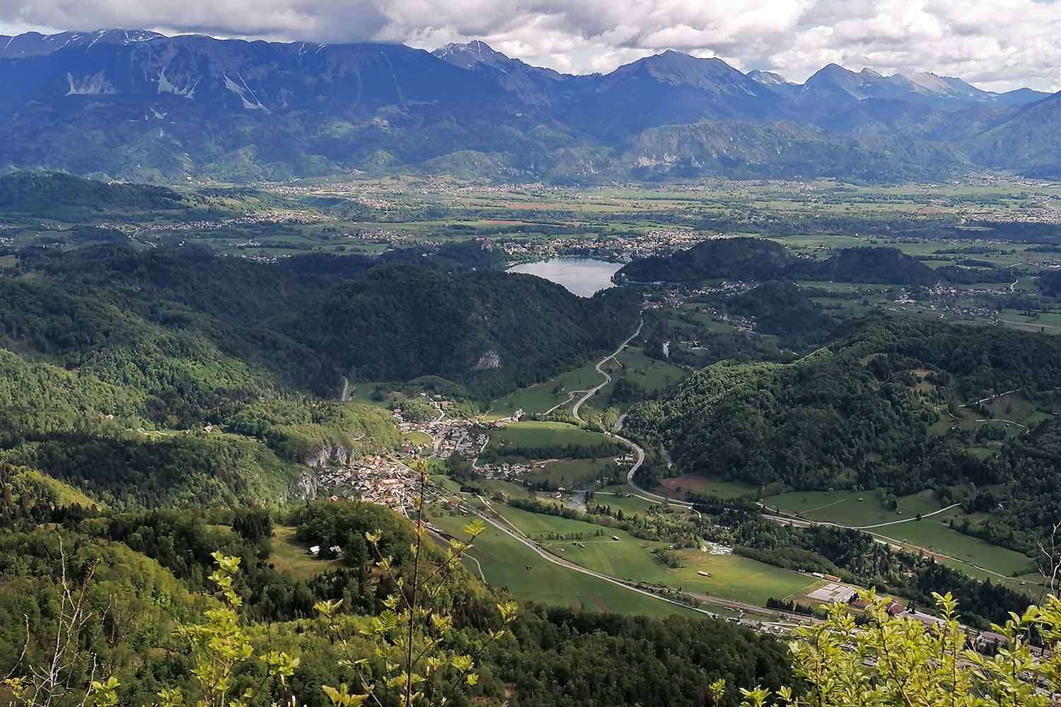
Galetovec is quite an unexpressive peak on the Pokljuka plateau. However, because of its 500 m precipitous cliff and safe ascent, not to mention the incredible view over the valley, it has been a popular destination of shorter and longer trips for years. The view opens suddenly and unexpectedly and reaches all the way from Jesenice to Kranj. On the right side, the mountains of Bohinj are nicely visible, with Bohinjska Bela and Bled deep beneath and the Babji Zob cliff on the opposite side which continues into the dark forests of Jelovica. The splendid view is concluded by the mighty barrier, which consists of Karavanke Range and highlands of Kamnik.

There are 4 routes to choose from, depending on physical fitness and available time. The summit can be reached either from the Sava Bohinjka valley, which takes 4 to 5 hours, or from Gorjuše or Belska Planina, which takes about two hours of comfortable walk. All routes are undemanding and the summit is accessible without any particular mountaineering outfits. There are no alpine posts on the way, so food and refreshments have to be brought along.
Access from Gorjuše
The trip from Gorjuše is particularly interesting for visitors of Bohinj or Pokljuka, as most of the route is done by car and is hence suitable for visitors with lack of time or physical fitness. When arriving from Bohinj and after going through the village Zgornje Gorjuše, turn right at the first turning. Park your car there and head to the left path, which goes parallel to the public road. Follow the directions on the signs. The entire trip takes 3 of an hour.
Access from Belska Planina.
About halfway between Gorjuše and Mrzli Studenec, a sign directs us left (coming from the direction of Mrzli Studenec), and after a couple of minutes the alpine meadow appears with numerous residences and cottages. Follow the path until a sign directs you right to another gently sloping path, which leads to the summit.
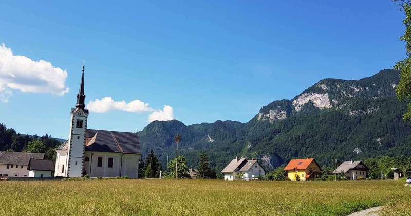
Access from Bohinjska Bela via Slamniki
The starting point is the Rot inn. The path leads over the Belca creek and a paved road through a part of the village called Graben. Immediately after passing under the railway, take the left path and after about 15 minutes of walk you arrive to the hamlet called Slamniki. Follow the path uphill until reaching the sign which directs you to the left, and then again take the steep path uphill until reaching the path from Belska Planina. Follow this path and go left at the crossroads, then follow the signs until reaching the summit. The entire ascent takes 2 to 21 hours.
Access from Bohinjska Bela via Zajama
The starting point is the Batišt inn opposite of the train station. Walk in the direction of Bohinj (and Obrne) and after about 100m leave the main road by turning right, then follow the gently sloping road leading through the forest. The path has many turns which can be cut, especially on the return trip. Following the signs, the alpine meadow of Zajama soon appears and shortly after that you can choose the path that leads from Gorjuše up to Galetovec. The entire trip takes 21 hours.
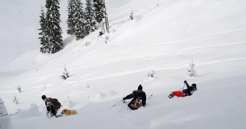
In February, the tourist association organises an EXPEDITION AND SKIING TOUR TO MOUNT GALETOVEC.